
The place
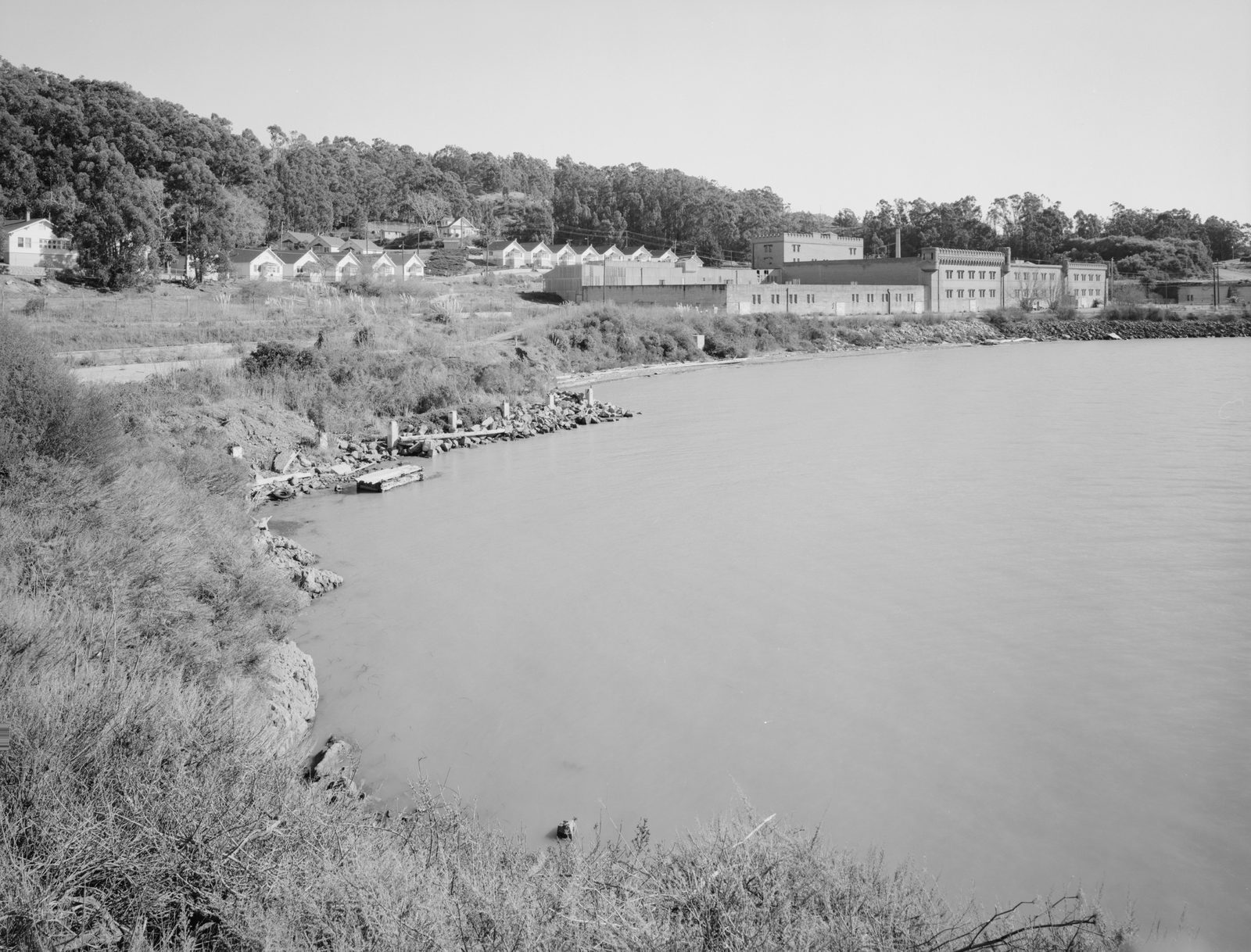
The Point San Pablo peninsula runs north from the Richmond–San Rafael Bridge to Point San Pablo. With Point San Pedro in Marin County, the point marks the San Pablo Strait between the two bays. The inland side holds Chevron’s refinery. The western side, below a ridge line 465 feet high, has been largely closed to the public for decades. East Brother Light Station, built in 1873, stands offshore.
Point Molate, where Winehaven sits, is a minor point on the peninsula’s western shore. Point San Pablo itself, farther north, was the site of the City of Richmond’s Terminal 4 port.
First peoples, the rancho, and the shrimp camp
The peninsula was home to the Huichin Ohlone, who left shellmounds along the shore. An 1811 mission-era diary records the headland as “Point Huchones”; later maps replaced the name with Point San Pablo.
The land lay inside Rancho San Pablo, a Mexican land grant of about 18,000 acres made in 1823 to Francisco María Castro and confirmed to his heirs in the 1830s. After Castro’s death the rancho was divided among his heirs and later partitioned by the courts into hundreds of lots.
Around 1870 (sources range from the late 1860s to 1871), Chinese shrimpers set up a camp on what is now Point Molate Beach Park. They worked from small Chinese-style boats with bag nets, boiled the shrimp in large cauldrons, and shipped them mostly to San Francisco; dried shrimp meal also went to China. The camp closed about 1912 as state and federal limits cut off the fishery. Archaeologists from UC Berkeley have documented the site (CA-CCO-506H), where dozens of Chinese Americans lived and worked for more than fifty years, and have warned that coastal erosion threatens what remains.
Rails, wharves, and oil
The Richmond Belt Line Railroad was organized in 1902 to serve the Standard Oil refinery, and in 1903 it was built out to Point San Pablo and the quarry near Castro Point. A wharf and warehouse at Point San Pablo followed, then a Standard Oil wharf, an oil-can factory, a brick factory, and two quarries. Santa Fe and Southern Pacific crews ran the trains in alternating cycles. A quarry opened south of Point Molate in 1906, and the short Castro Point Railroad connected it to the Belt Line. Pacific Coast Oil, which became Standard Oil of California in 1906 and Chevron in 1984, started its refinery on the far side of the ridge in 1901.
The wharf at Point San Pablo shipped goods as varied as wine, kerosene (“case oil” packed two cans to a crate), and, from 1917, imported coconut and other vegetable oils; molasses followed. In 1932 the Parr-Richmond Terminal Corporation took over the wharf, and in 1936 the City of Richmond bought the wharf and nearby land and leased them back to the company for fifty years. Parr’s operation became known as Terminal 4. In 1937 the sardine boom brought a rush of fish-reduction plants to the shore between Point Molate and Point San Pablo.
Winehaven and the Navy
The California Wine Association was formed in San Francisco in 1894 by seven leading wine firms during a depression in the wine trade. After the 1906 earthquake destroyed its city cellars, it bought land at Point Molate in December 1906 and built Winehaven from 1907, using the Belt Line, its own electric railway, and a deep-water wharf. The Historic American Buildings Survey documents a first crush in the fall of 1907 in the west wing of Building 6, although several general wine histories say crushing began only in 1911. Most of the complex was running by 1908–1909. The plant ran until Prohibition. The Winehaven post office was withdrawn on February 4, 1925.
The Navy took over for a fuel depot in World War II. Sources date its purchase of the Winehaven land to 1941. Federal court records show Congress authorized naval refueling facilities in April 1942 and that the Navy took possession of the site by condemnation, under a court order, that year, so the depot was being built and operating in 1942. The Navy added a new pier, drum-storage areas, rail spurs, 17 miles of pipeline, and 75 tanks. The depot was decommissioned on September 30, 1995. In September 2003 the Navy conveyed most of the property (80 to 85 percent, depending on the source) to the City of Richmond for one dollar; the rest followed in 2010.
Ferries, the port, the harbor, and the whalers
From the mid-1910s until the Richmond–San Rafael Bridge opened in 1956, a ferry ran from Point Castro to San Rafael, founded by Captain Raymond Clark. The bridge ended the ferries.
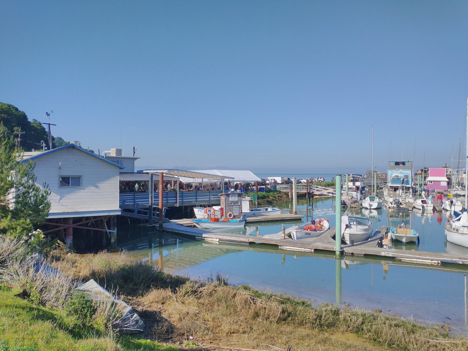
Captain Raymond Clark also built Point San Pablo Yacht Harbor, forming its breakwater from sunken steam-schooner hulls. The harbor’s own history dates the breakwater to 1939. The Army Corps of Engineers approved the harbor in May 1940, and it began advertising that September. (A 2015 magazine account dates it to 1930; the 1939–1940 dates fit the primary evidence better.) The harbor still operates and is the boat access to East Brother Light Station.
During World War II the Navy used the docks at Point San Pablo to ship ordnance. In 1956 Del Monte built a whale-processing plant on the eastern side of the point. It was the last whaling station in the United States and closed in 1971, when federal law ended commercial whaling. Port operations faded after that. The City took over Terminal 4 in 1973. The last industrial tenants, a molasses company and a tank-storage operator, left in 1993 and 2000, and the City removed the great wharf and its pilings in 2024–2025.
Today and tomorrow
In August 2025 the East Bay Regional Park District bought 82 acres at Point Molate, including Winehaven, for $40 million, and began building a 2.5-mile Bay Trail extension that it expects to open in 2027. The park district describes Point Molate as a 420-acre site, with the City of Richmond owning the remaining 338 acres.
Farther north, the City owns the 47-acre former Terminal 4 at Point San Pablo, under a lease that runs to 2030. Bay Trail advocates are urging that it become part of a regional shoreline park, with a 1.5-mile trail link to the harbor. Chevron owns the land between and has said it will allow a trail easement; a narrow railroad-owned corridor remains an obstacle.
Sources
- Bay Crossings staff report, “The Unique and Colorful History of Richmond’s Point Molate,” July 2015. baycrossings.com
- East Bay Regional Park District, “Future Point Molate Park.” ebparks.org
- Historic American Buildings Survey, Winehaven, HABS CA-2658, written historical and descriptive data, 1996. loc.gov
- National Register of Historic Places Inventory–Nomination Form, Winehaven, NRHP 78000658. npgallery.nps.gov
- United States v. 412.715 Acres of Land, 53 F. Supp. 143 (N.D. Cal. 1943). justia.com
- California Wine Association records, 1894–1936, Online Archive of California. oac.cdlib.org
- El Cerrito Historical Society, “East Shore & Suburban Railway & other El Cerrito Railroad Chronology” (compiled 2012). elcerritohistoricalsociety.org
- George C. Collier, “Point Molate,” 1976 (published as a chapter of a Contra Costa County history).
- Point Richmond History Association, This Point…in Time, Vol. XXIII No. 4 (Dec./Jan. 2005), Winehaven article. pointrichmondhistory.org
- Point Richmond History Association, This Point…in Time, Vol. XLV No. 5 (April/May 2026), article on Point San Pablo.
- Point San Pablo Harbor, “History.” pspharbor.com
- William A. White III, “Heritage is Eroding: The Point Molate Shrimp Camp and Coastal Erosion in Richmond, California,” Society for Historical Archaeology, 2024. tDAR
- City of Richmond, “Point Molate.” richmondca.gov
- Richmondside, “It’s official: Point Molate preserved as public parkland,” August 26, 2025. richmondside.org
- Richmondside, “Here’s what you might see if Point San Pablo becomes a shoreline park,” July 13, 2026. richmondside.org
See also: The history of Winehaven · Lucretia Edwards · Photograph gallery · Winehaven in the press